Mines students to resurvey Mile High Marker at State Capitol to celebrate Colorado's 150th anniversary
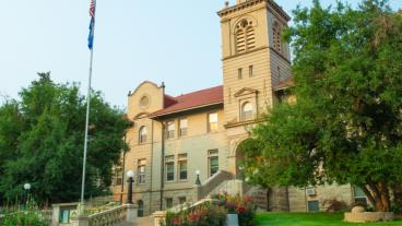
Official elevation of the "Mile High City" is measured by the marker on the west steps of the State Capitol in downtown Denver
Colorado School of Mines is home to some of the best student surveyors in the nation. Over the next year, they'll get to put their skills to the test and contribute to a permanent part of Colorado history.
In honor of Colorado's 150th anniversary in 2026, a team of Mines students has been tasked with re-surveying the famed Mile High Marker on the west steps of the Colorado State Capitol in Denver. It will be the fourth survey conducted since the building opened in 1894 and the first since 2003. The official elevation of the “Mile High City” is measured on these west steps outside the gold-domed building.
The Mines students, advised by Jeffrey Holley, associate teaching professor of civil and environmental engineering, and volunteer professional surveyors, will use three techniques to determine the exact location of 5,280 feet above sea level:
- Traditional Engineers Level and Level Rod: This tried-and-true instrument has been used by surveyors for centuries and is still a common tool used on construction sites today.
- Total Station: Capable of measuring both horizontal and vertical angles and distances, this instrument is the go-to equipment for cadastral surveys, used to define or reestablish land parcel boundaries, as well as collecting surface data
- GNSS / GPS Rover: This state-of-the-art instrument uses satellite technology to accurately locate a monument's elevation.
“Engineering surveying is the beginning, middle and end of every project, and learning the different way to conduct a survey is a rite of passage for every civil engineering student at Colorado School of Mines," Holley said. "We're honored to have our championship-caliber student surveyors put those skills to work over the next year in service of the most iconic monuments in the state of Colorado, the Mile High Marker at the State Capitol. As our world changes, our established monuments need a checkup now and again and we're looking forward to using the most current vertical datum while honoring surveying tradition by using three approaches from classic instruments to state-of-the-art technology."
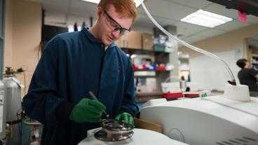
At Mines, civil engineering students get their first introduction to surveying during Field Session, an intensive hands-on learning experience taken during the summer between students' sophomore and junior years.
In a 100-plus-acre field below Mount Zion in Golden, students conduct daily land surveying challenges for three weeks, first using traditional surveying equipment, such as using their own legs for pacing, a 100-foot steel tape and a hand level, before moving on to more modern equipment like an engineer’s level and Total Station.
During the fall semester, students can also take an advanced surveying course where they take their skills to the next level with topics ranging from engineering astronomy and computer-generated design to GPS data applications in engineering projects. They practice road design and field layout fundamentals such as centerline staking, horizontal and vertical curves, slope staking and earthwork volume calculations.
Surveying isn’t only a matter of classwork, either: Mines students compete – and win – in surveying as part of the annual American Society of Civil Engineers Student Competition.
Over the summer, Mines placed third nationwide in the 2025 National Utility Engineering and Surveying Institute Surveying Competition. In the four years the competition has existed, Mines has won at the regional level every year and finished in the top four nationally in all but one year, winning the national title in 2022.
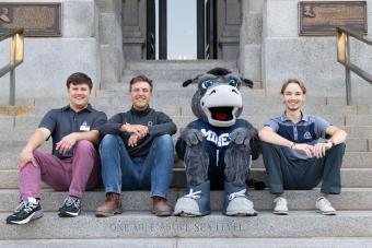
“As a civil engineering student and a geography and history buff, I am elated to have the opportunity to be a part of a project that is integral to the identity of Denver and Colorado,” said Andrew Hurter, one of the Mines students who will be contributing to the survey.
The new Mile High Marker will be unveiled on the steps of the State Capitol on Aug. 1, 2026 as part of the state’s 150th anniversary celebration. Nicknamed the Centennial State, Colorado was granted statehood on Aug. 1, 1876, the same year as the United States celebrated its 100th anniversary.
“The Mile High Marker on the West Steps of the Colorado State Capitol is a symbol of all that makes Colorado unique. There are other states that have 14,000-foot peaks, but no one has as many as we do. There are other states that have professional sports teams but the altitude imbues our athletes with just a little more endurance. Other state capitols have lovely views, but none quite so spectacular as our view of the Front Range. And (two) other states have higher capital cities, but no other sits at exactly one mile high,” said Amanda Clapham, Lead Capitol Education and Art Curator for Legislative Council Staff at the Colorado State Capitol. “This anniversary could be seen as arbitrary to some, but it's a moment in time, a snapshot of who and what we are as a state. We’re proud to have one of the most prestigious universities in Colorado measure this marker for us, and prouder still to be a part of the momentous occasion.”
Learn more about Colorado’s sesquicentennial on the History Colorado website.

About Mines
Colorado School of Mines is a public R1 research university focused on applied science and engineering, producing the talent, knowledge and innovations to serve industry and benefit society – all to create a more prosperous future.