Mines researchers on two finalist teams for $310M NASA Earth System Explorer mission
Geophysics' Bia Villas Bôas and Matthew Siegfried are members of two proposed missions to improve understanding of key Earth science focus areas
Colorado School of Mines geophysics researchers are contributing to two of the four missions recently selected by NASA to move forward in the Earth System Explorer Program competition.
The competition – which will ultimately select two proposals to launch in 2030 and 2032 with a budget of $310 million per mission – aims to improve understanding of key Earth science focus areas for the benefit of all, including greenhouse gasses, the ozone layer, ocean surface currents and winds, and changes in forest structure, glaciers, and ice sheets around the world.
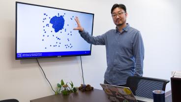
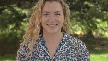
Bia Villas Bôas, assistant professor of geophysics, is on ODYSEA, and Matthew Siegfried, associate professor of geophysics at Mines, is a member of the EDGE mission. Both missions are being led by the University of California San Diego and will receive $5 million each to develop a more fully fleshed out concept proposal over the next year.
"NASA competes these missions to find the most exciting and most impactful mission concepts for all of Earth science – seeing that Mines Geophysics is helping to guide two of the four remaining concepts speaks volumes about Mines' place in earth, and specifically climate, research,” Siegfried said.
Ocean Dynamics and Surface Exchange with the Atmosphere (ODYSEA)
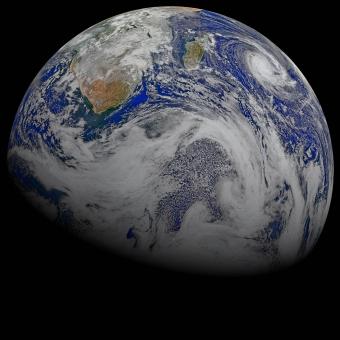
ODYSEA, short for Ocean Dynamics and Surface Exchange with the Atmosphere, is a satellite that will measure ocean surface currents globally for the first time and simultaneously measure winds over the ocean.
Led by Scripps Institution of Oceanography physical oceanographer Sarah Gille, the ODYSEA satellite will be powered by a Doppler scatterometer, which use radar signals to measure wind speed and direction. As a groundbreaking innovation, ODYSEA will also measure the speed and direction of surface currents by taking advantage of the Doppler shift in the radar signal caused by the motion of the ocean surface. This technology has been tested and validated from aircraft during a recent NASA Earth Venture Suborbital-3 (EVS-3) mission called S-MODE, on which Villas Bôas is part of the science team.

By measuring daily global surface currents and their interactions with wind, ODYSEA will provide essential information to refine weather and climate models. These data will enhance understanding of how ocean currents influence the atmosphere, improving predictions for weather, climate and ocean circulation.. This information is crucial not only for scientific understanding but also for practical applications such as search-and-rescue operations, fisheries management and tracking environmental events like oil spills.
"The ocean and the atmosphere form a coupled system, constantly talking to each other through exchanges of heat, momentum, energy and gasses,” Villas Bôas said. “Although these interactions are key for predicting weather and climate, they remain poorly observed. ODYSEA will deliver unprecedented spatial and temporal coverage of ocean surface winds and currents simultaneously, which will be particularly critical for improving our understanding of ocean heat and carbon uptake."
At Mines, Villas Bôas will be leading ODYSEA's open science efforts, which include data and software dissemination, and training the user community to accelerate the use and integration of ODYSEA data. Additionally, Villas Bôas's research group will be investigating the effects of coastal topography on wind-current coupling.
The international team led by Gille is a U.S./French collaboration and includes more than 20 partners, including Melanie Fewings from Oregon State University, Mark Bourassa from Florida State University, Tong Lee from the Jet Propulsion Laboratory, and Fabrice Ardhuin from the Laboratoire d'Océanographie Physique et Spatiale. Other team members are located at Jet Propulsion Lab, the French space agency CNES, Woods Hole Oceanographic Institution, NOAA, the US Naval Research Lab, and multiple French research organizations.
Earth Dynamics Geodetic Explorer (EDGE)
EDGE – short for Earth Dynamics Geodetic Explorer – proposes to measure the three-dimensional structure of terrestrial ecosystems like forests and the surface height of glaciers, ice sheets and sea ice as they change in response to human activity.
Led by Helen Amanda Fricker, a glaciologist at Scripps, the mission builds on and advances the laser technology used on NASA’s Ice, Cloud, and land Elevation Satellite (ICESat), its follow-on mission ICESat-2 (a mission on which Siegfried serves as a Science Team member), and the Global Ecosystem Dynamics Investigation (GEDI) instrument on the International Space Station. Whereas ICESat had a single beam measuring surface height of the Earth beneath the satellite, ICESat-2 has six beams and GEDI has eight beams; EDGE, through the use of new technology, will have 40 beams that will map the planet in five 120-meter wide strips with every orbit.
The higher spatial coverage and increased accuracy will enable a more comprehensive view of the dynamics of the Earth’s surface. This unprecedented resolution of the depth, height and structure of terrestrial and ice systems will allow scientists to precisely measure changes as they are happening. By tracking carbon stored in forests and the volume of ice at the poles, scientists will be able to use EDGE data to provide a real-time look at how the planet is responding to climate change and if it is crossing critical tipping points that will cause abrupt or irreversible change.
EDGE will fly on Maxar’s 500 series spacecraft, and expand the footprint of our planet that is monitored. GEDI, on the ISS, only covers as far north as Canada and south to Chile, but EDGE’s orbit goes all the way to the poles providing global coverage of vegetation including the boreal forests and allowing for the densest mapping yet around the edges of ice sheets and sea ice pack.
“Having an instrument in space capable of measuring the height of the Earth’s surface to an accuracy of inches on a spacecraft with the agility of Maxar’s 500 series platform will allow us to build three-dimensional models of the rapidly changing edges of the cryosphere at a quality previously only attainable from aircraft,” Siegfried said. “The scientific value of this capability for identifying vulnerabilities in the Earth’s climate system from space at regular intervals is immeasurable.”
At Mines, Siegfried will be part of the project’s ice elevation team, helping to design the data products for glaciers, ice sheets and permafrost. He will also lead the validation of ice elevation data products, developing techniques for assessing the uncertainty of what will likely be the most accurate spaceborne altimeter ever launched.
The EDGE team is comprised of 25 scientists and engineers from around the world, including leadership that includes John Armston from the University of Maryland and Bryan Blair and Scott Luthcke from NASA Goddard Space Flight Center. Scientists from the University of Maryland, U.S. Forest Service, George Mason University, Boise State University, Northern Arizona University, U.S. Geological Survey, Bristol University, National University of Singapore, and the Smithsonian Tropical Research Institution round out the team for terrestrial ecosystem structure, while the ice elevation team also features scientists from the University of Washington, University at Buffalo, the Australian Antarctic Division and the University of Tasmania.

About Mines
Colorado School of Mines is a public R1 research university focused on applied science and engineering, producing the talent, knowledge and innovations to serve industry and benefit society – all to create a more prosperous future.