Ebru Bozdag wins NSF CAREER Award to improve seismic images of Earth’s deep interior
The 3D scans are obtained by a technique called seismic tomography – like medical CAT scans but using the seismic waves generated by earthquakes.
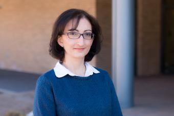
Ebru Bozdag, assistant professor of geophysics at Colorado School of Mines, has received a National Science Foundation CAREER Award for work to improve the resolution of 3D scans of the Earth’s mantle – research that will lead to better insight into the inner dynamics of our planet.
The 3D scans are obtained by a technique called seismic tomography – similar to medical CAT scans, but using seismic waves generated by earthquakes. Bozdag will use the state-of-the art tomographic techniques and emerging datasets from oceans to construct high-resolution models for understanding the structure, composition and dynamics of the Earth’s mantle, which shape the surface of the planet through tectonic processes such as earthquakes and volcanic activity.
Bozdag will receive $620,624 over five years for the project, “(An)elastic mantle structure based on 3D wave simulations & full waveform inversion: From GLobal ADjoint models to visualization of Slabs, Plumes And Convection in MANtle.”
Here, she answers a few more questions about her research, the wealth of information these seismic “CAT scans” provide and how her favorite childhood book factors into it all.
Q: What is your latest research focused on?
A: My research focuses on imaging Earth’s deep interior, more specifically constructing three-dimensional global models from the surface down to the core-mantle boundary at about 2,900 km depth. I use seismic waves generated by earthquakes that travel all around the globe and carry information about the Earth’s interior. Like other seismologists, I analyze these seismic waves and compare them to simulated data to understand how far we can interpret our planet. I use a technique called seismic tomography, which is similar to medical tomography, to obtain 3D CAT-scan images of the crust and mantle in terms of seismic parameters, such as wavespeeds, density, anisotropy and attenuation of the medium that waves propagate through.
Classically, seismic tomography relies on some approximations to simulate the wave propagation and corrections to deal with some complexities of the Earth. We are at a stage now where further refinements of the tomographic images require taking the full complexity of wave propagation into account in our measurements and modeling. Advances in high-performance computing and numerical methods, together with the increase in the quality and amount of seismic data worldwide in recent years, have provided us new opportunities to improve the resolution of tomographic models. In my research, I am taking advantage of full 3D numerical seismic wave simulations at the global scale and incorporate them in seismic full-waveform tomography, avoiding commonly used approximations and corrections in classical techniques. These simulations and modeling techniques require high-performance computing.
In this NSF CAREER project, my goal is to investigate the multi-scale structure of the mantle, also addressing the anelasticity. Although attenuation, a measure of the energy loss of seismic waves, is a key parameter to detect partial melt, thermal variations and water content in the mantle, most of the seismic tomographic studies aim to obtain elastic models only mainly because of the challenges to construct the anelastic structure. I will try to address these challenges with 3D numerical simulations that capture the full physics of wave propagation both in computation of synthetic waveforms and construction of tomographic model by constraining the elastic and anelastic mantle structures simultaneously. On the other hand, advances in wave simulations and imaging techniques have to be complemented by data. I will also work toward assimilating emerging datasets from oceans in addition to traditional waveforms into full-waveform tomography to improve global data coverage and the resolution specifically underneath oceans.
Q: What do you find most exciting about your research?
A: The deepest drilling into the Earth is about 12 km. Compared to the radius of the Earth, which is 6,371 km, this is just a tiny scratch at the surface. Jules Verne’s “Journey to the Center of the Earth” was one of my favorite books when I was a child. I think global seismologists make this journey possible through seismic waves. It is super exciting to “see” the Earth’s interior with seismic wiggles and try to understand how our planet is working, how it was formed and how it has been evolving over time. Furthermore, my research unifies recent advances in the theory, data and high-performance computing as well as interpretation of inner workings of the planet, which gives me ample opportunities to collaborate with scientists from different disciplines such as theoretical and observational seismologists, computational scientists, geodynamicists, applied mathematicians, etc.
Q: What is the potential impact of this work?
The Earth is a giant system where every piece is related to each other. To better understand the entire system and what is happening around us, we need to look deeper. High-resolution present-day snapshots of Earth’s interior are essential for understanding the past and present dynamics of the mantle, which directly shape the surface of our planet through tectonic processes such as earthquakes and volcanic activities. Higher-resolution models are also crucial for better understanding the source of earthquakes, accurately locating them, and are required from an engineering point of view to assess and mitigate seismic hazard and to detect nuclear explosions. The elastic and anelastic constraints will help interpret the water content in the mantle, thus improving our understanding of the water cycle on our planet. The project outcomes will provide critical parameters to mineral physicists and geodynamicists to have better insight into the composition and thermal evolution of our planet, facilitating interdisciplinary research. The techniques we are using are also commonly used, for instance, in the oil and gas industry and medical imaging that the cross-talk between these fields and the global geophysics will be beneficial to advance science in all these different domains.
Q: How does this research agenda inform your teaching?
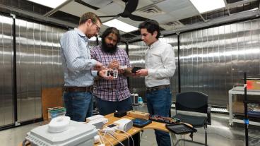
Robust and efficient visualization tools are necessary to investigate large-scale models thoroughly. Collaborative immersive virtual reality (VR) environments have become useful tools in Earth sciences, facilitating 3D visualization for exploring data and models for scientific and engineering research as well as advancing education and public outreach. The necessity of visual materials to strengthen and enhance the learning process in and outside the classroom is also reported in the educational literature. My personal experience in my lectures and the feedback I get from students support this observation as well. To facilitate effective exploration of Earth’s mantle for research and educational activities, constructed models together with data from other disciplines will be used to design an interactive, collaborative Earth model called SPAC-MAN (Slabs, Plumes And Convection in MANtle), for visualization in virtual and augmented reality environments and planetariums. The collaboration with the Denver Museum of Nature & History, and potentially with other natural sciences museums in the U.S., will reach a range of age groups from children to adults, educating them on the interior of our planet and its dynamics while promoting STEM fields.
With the aid of visualization tools and techniques, SPAC-MAN will also serve to promote deep Earth and planetary sciences at Mines. SPAC-MAN will be used in classes at Mines as supportive material for lectures and group projects. Both undergraduate and graduate students will participate in designing SPAC-MAN as active researchers, gaining hands-on practice on 3D visualization, integrating models into VR systems, analyzing and interpreting various other geophysical data and models of the mantle. The project will create opportunities for senior design projects, undergraduate research projects and independent studies, not only for geophysics but also potentially for computer science and applied math students cultivating interdepartmental collaborations at Mines.

About Mines
Colorado School of Mines is a public R1 research university focused on applied science and engineering, producing the talent, knowledge and innovations to serve industry and benefit society – all to create a more prosperous future.