West Antarctic Ice Sheet retreated, re-advanced up to 160 miles since last ice age
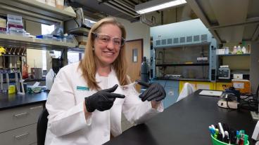
Mines' Ryan Venturelli led the new study, published in AGU Advances, that constrained the Antarctic subglacial carbon cycle for the first time
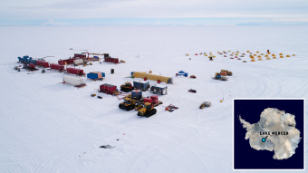
Drone view of the historic Antarctic expedition from December 2018 to January 2019 where SALSA researchers accessed a subglacial lake for only the second time in history and retrieved the longest sediment core from a subglacial lake. Mercer Lake, the subglacial lake in question, is located a few hundred miles from the South Pole. (Photo Credit: Billy Collins)
The West Antarctic Ice Sheet is melting rapidly, raising concerns it could cross a tipping point of irreversible retreat in the next few decades if global temperatures rise 1.5 to 2.0 degrees Celsius (2.7 to 3.8 degrees Fahrenheit) above preindustrial levels.
New research led by a Colorado School of Mines paleoglaciologist found that 6,000 years ago, the grounded edge of the ice sheet may have been as far as 250 kilometers (160 miles) inland from its current location, suggesting the ice retreated deep into the continent after the end of the last ice age and re-advanced before modern retreat began.
“In the last few thousand years before we started watching, ice in some parts of Antarctica retreated and re-advanced over a much larger area than we previously appreciated,” said Ryan Venturelli, assistant professor of geology and geological engineering at Mines and lead author of the new study. “The ongoing retreat of Thwaites Glacier is much faster than we’ve ever seen before, but in the geologic record, we see the ice can recover.”
The study appears in AGU Advances, which publishes high-impact, open-access research and commentary across the Earth and space sciences. It presents the first geologic constraint for the ice sheet’s location and movement since the last ice age.
The grounding line is where a glacier or ice sheet leaves solid ground and begins to float on water as an ice shelf. Today, the Ross Ice Shelf extends hundreds of miles over the ocean from the grounding line of the West Antarctic Ice Sheet. Because ocean water washes up against the leading edge of the ice, the grounding line can be a zone of rapid melting.
“The concern of grounded ice loss is because the loss of ice on land is what contributes to sea level rise,” Venturelli said. “As grounding lines retreat farther inland, the more vulnerable the ice sheet becomes as it exposes thicker and thicker ice to the warming ocean.”
During the Last Glacial Maximum, about 20,000 years ago, the West Antarctic Ice Sheet was so large that it was grounded on the ocean floor, beyond the edge of the continent. Previous observations generally indicate a steady retreat since then, accelerated in the last century by human-caused climate change.
The question for Venturelli was just how far inland the ice sheet had retreated after the last ice age. Without knowing that, it’s hard to predict how sensitive the Antarctic Ice Sheet is and how it will respond to further climate change.
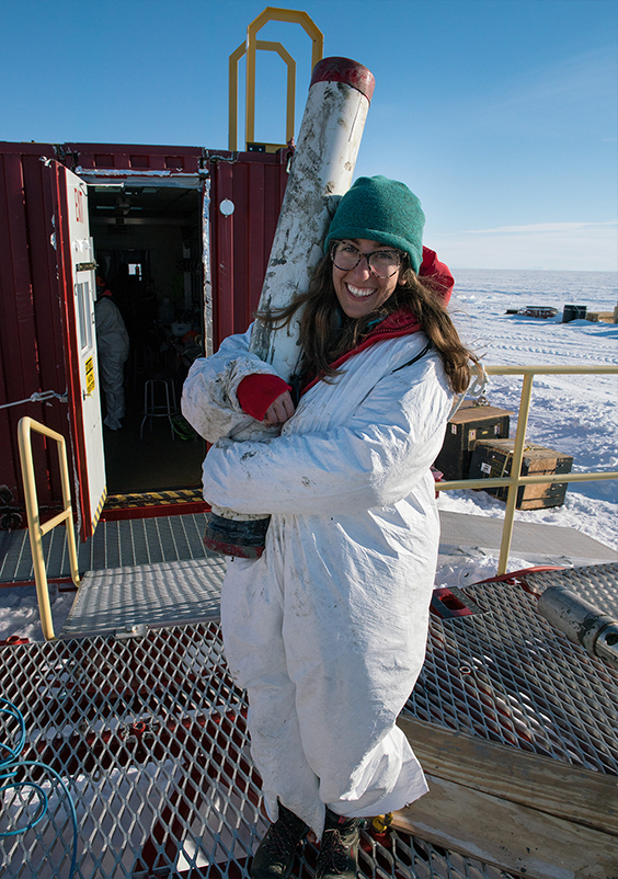
A lake about twice the size of Manhattan buried under a kilometer (0.6 miles) of ice and sealed off from today’s atmosphere held clues to the answer. To reach it, Venturelli and her team carefully melted their way in with a hot water “drill.” Once they had access, they pulled up samples of lake water and carbon-filled sediments from the lake bed. Using radiocarbon dating, they found the carbon was about 6,000 years old.
Because radiocarbon (carbon-14) in these sediments must have come from seawater, the finding suggests that what is now a lake 150 kilometers (93 miles) from the modern ice edge was the floor of the ocean. When the ice advanced, it capped off the lake, preserving the carbon as part of the lake bottom’s sediments. And based on radiocarbon in water sampled from the same lake, the grounding line could have been 100 kilometers (62 miles) even farther inland at that time.
“When we set out to sample this lake, we weren’t sure what we would find out about ice history, but the fact that deglaciation persisted this far inland was not that wild of a possibility,” Venturelli said. “This area of West Antarctica is really flat. There is nothing to put brakes on the retreat of the grounding line. No real topographical doorstops.”
The new evidence of Antarctic ice’s ability to make a comeback was welcome news for Venturelli.
“It can be a bummer sometimes, studying ice loss in Antarctica,” Venturelli said. “Although the re-advance identified in the geologic record happens over thousands of years, I like to think of studying the process of reversibility as a little shred of hope.”
The next big question for Venturelli and her coauthors is assessing what conditions enabled the ice’s re-advance. One possibility is the rebound after release from the massive weight of the ice sheet lifted the land enough to hold back the ocean and allow the ice to regrow. Another possibility is that slight changes in climate enabled the ice sheet to switch from retreat to advance. It could have been a combination of these influences.
Significance of the sampling effort
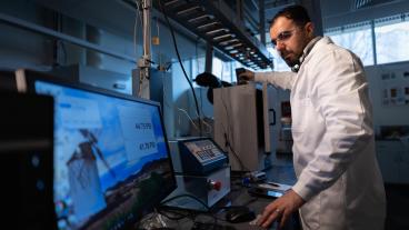
Venturelli's findings join two other recent publications from the NSF-funded Subglacial Antarctic Lakes Scientific Access (SALSA) team, based on sediment samples retrieved from Mercer Subglacial Lake. In February, researchers published work in ISME Communications that examined and compared microbial communities in the sediment to other regions under the ice; their work indicated an extensive subglacial ecosystem that is biogeochemically and evolutionarily linked through ice sheet behavior and the transport of microbes, water and sediments. In March, Geology published the findings from the analysis of the first layered sediments ever recovered from beneath the modern Antarctic ice sheet. Also lead authored by Venturelli and Matthew Siegfried, assistant professor of geophysics at Mines, the analysis showed a pattern of contrasts that indicated the subglacial lake was filling and draining with water before the scientists’ observational record — movement that has implications for how the ice sheet moves and contributes to sea level rise.
The saga of the SALSA team’s quest to explore subglacial lakes is chronicled in “The Lake at the Bottom of the World,” a feature-length documentary film released across multiple streaming platforms on February 28 by the team in partnership with Metamorph Films. The NSF-funded film gives viewers a close look at how the scientists conducted their work amid harsh Antarctic conditions.
To read the full study in AGU Advances, "Constraints on the Timing and Extent of Deglacial Grounding Line Retreat in West Antarctica," go to https://doi.org/10.1029/2022AV000846.

About Mines
Colorado School of Mines is a public R1 research university focused on applied science and engineering, producing the talent, knowledge and innovations to serve industry and benefit society – all to create a more prosperous future.