Emptying aquifers creating sinkholes, economic issues worldwide
Mines researchers study harm posed by empty aquifers, from areas at risk for sinkholes to economic consequences
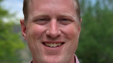
Pejman Tahmasebi, associate professor of petroleum engineering, worked on a global map showing areas at risk of subsidence due to emptying aquifers.
Photo by Tim Meyer/Colorado School of Mines
Depending on where you live, water from underground sources may be crucial for survival. In states with climates like California and Texas, groundwater is important not only for industries like agriculture and oil and gas but also for everyday activities, like watering a garden or taking a shower.
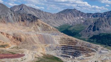
But around the world, the rate of development is outpacing the ability of aquifers – underground areas where water collects through porous rock – to absorb enough water to keep them from running empty. When aquifers empty, subsidence – the sinking of the Earth’s surface – becomes a serious concern and places people in danger. And for places whose economic futures depend on enormous sources of groundwater, like the Ogallala Aquifer beneath the Great Plains, subsidence can be a sign of big changes ahead.
Two Mines faculty members have been working on better understanding aquifers, both on a very local and global scale, and how those aquifers impact the people who rely on them.
GLOBAL CONCERN
Pejman Tahmasebi, associate professor of petroleum engineering, has been creating a global map of subsidization areas, using machine learning and data from a variety of sources to develop a model to predict where subsidence may occur.
He found a common factor in areas with high vulnerability – groundwater extraction.
“Wherever we have abnormal extraction of groundwater, then we have subsidence in that part of the world,” Tahmasebi said.
And while similar maps exist, the scope of the map Tahmasebi and his team created is vaster.
“What makes this study different from previous ones is that it covers the whole globe,” he said. “High resolution data can focus on specific areas, which can be more accurate, but it doesn’t cover the area of a global map.”
The map doesn’t just point out where subsidence can happen, either — it quantifies the level of risk.
And the risk of subsidence does vary depending on the region. Tahmasebi said parts of Asia – like in India, Pakistan, Iran and Indonesia – are increasingly dealing with subsidence for several reasons, but removing groundwater is a big factor. In Iran, Tahmasebi said, groundwater is being extracted and close to 85 to 90 percent of it is being used for agriculture, and then not being replaced. Coupled with periods of drought, it’s a dangerous recipe for subsidence, which can damage and destroy infrastructure and buildings in populated areas. Having an understanding of subsidence risk before it happens can help cities manage the issue.
UNDERSTANDING HISTORY
While Tahmasebi’s work is global in scale, Lucas Bessire, professor of anthropology, is focused on one specific North American region.
Bessire grew up in western Kansas, where for five generations his family has farmed and relied on the Ogallala Aquifer for survival.
“My particular investment in aquifer issues came because of my interest in reconnecting with my father in western Kansas and learning through him that he was concerned about the dropping water table there. It became a concern that we could share,” he said.
The Ogallala Aquifer spans eight U.S. states and is a major water source for much of the Great Plains. It lies beneath some of the most productive farmland in the country, where large-scale farming of corn, wheat and soybeans, along with a strong livestock industry, uses water pumped from the aquifer. About 70 years ago, agricultural practices shifted, with the new irrigation systems pulling from the Ogallala Aquifer at rates faster than the water table could be replenished.
“I’ve learned a lot about how groundwater operates in western Kansas. There’s a very small recharge rate, between 1/10 of an inch and one inch per year, because of the nature of how that groundwater is stored and where it’s located, deep below the surface, without a lot of interaction with the top,” Bessire said.
Deep isn’t an overstatement. The depth of the Ogallala Aquifer varies by location, but it has an average thickness of around 200 feet and sometimes can exceed 1,000 feet. Any water moving through the layers of silt, shale and clay to make it back to the aquifer takes a very long time to get there, Bessire said.
The slow recharge rate isn’t a secret, either. The content of the Ogallala Aquifer is sometimes called “fossil water,” he said. Because that water is old and has been in the aquifer for so long, it’s considered a non-renewable resource.
For his research, he collaborated with his father for two years to talk to water policy experts, farmers and local Kansans to better understand what was happening with the “fossil water” and how its depletion was connected to the people living above it.
“There’s a way in which our relationships to aquifers are the same as our relationships to each other and future generations,” he said. “There’s a lot of mythological ways of understanding aquifers that can contribute to depletion. Those myths make aquifer depletion a kind of historical consciousness that resonates with earlier modes that happened in those very same places.”
STOPPING THE SINK
Bessire’s research on the Ogallala Aquifer led to his writing the book “Running Out: In Search of Water on the High Plains.” Through examining the practices that have led to the depletion of the aquifer, Bessire said he better understood how his own family in the area is connected to it.
“There’s a personal and emotional dynamic. I learned that by reconnecting with my father, through the process of trying to understand what was happening to the aquifer and how our family was involved, and I ended up telling the story of aquifer depletion as partly a story of a family,” he said.
With aquifer depletion and subsidence becoming a growing concern, better understanding ways to improve the situation is a priority. Tahmasebi was recently quoted in a Washington Post article about subsidence and the need to better understand the problem, so groundwater management and urban planning can slow the danger. In a study unrelated to Tahmasebi’s work, researchers found that 98 percent of Chicago, Dallas, Detroit, New York and Denver, among other major American cities, is affected by sinking land. Their study has garnered extensive coverage from numerous national and international media outlets and organizations, including The Washington Post, Forbes, The Financial Times, Deutsche Welle, the United Nations, UNESCO, the World Economic Forum and many others.
Some areas have started to notice the problem and shifted their practices to protect crucial infrastructure. Houston, for example, is trying to increase its use of surface water, relying more on things like reservoirs and re-directing water that often causes flooding.
“Water withdrawal should be our last option,” Tahmasebi said. “We should be finding other ways besides extracting water from the deepest parts of the Earth.”

About Mines
Colorado School of Mines is a public R1 research university focused on applied science and engineering, producing the talent, knowledge and innovations to serve industry and benefit society – all to create a more prosperous future.