A Colorado School of Mines geophysics professor was part of a team of scientists investigating an Antarctic ice shelf the size of Colorado and Utah combined that discovered an ancient geologic structure that controls the flow of ocean water deep under the shelf.
 Researchers working on the project ROSETTA-Ice also mapped the thickness and internal structure of the ice shelf, and identified a new mechanism for weakening large ice shelves that are presently stable. They published details today in the journal Nature Geoscience.
ROSETTA (Ross Ocean and Ice Shelf Environment, and Tectonic setting Through Aerogeophysical surveys and modeling)-Ice is a three-year interdisciplinary survey of the floating Ross Ice Shelf, which slows the flow of about 20 percent of Antarctica’s grounded ice, equivalent to 38 feet of global sea level rise.
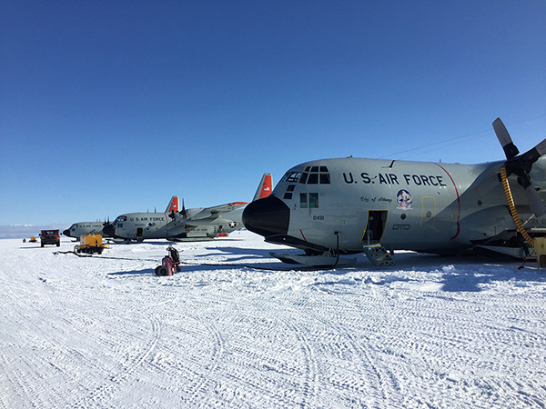
Matthew Siegfried, a physical glaciologist and assistant professor of geophysics at Mines, has been a part of this project for five years, including deploying to McMurdo Station in Antarctica in November 2015 for airborne data collection and helping to interpret the radar and lidar observations.
“Our conceptual understanding of Antarctica is still so new that we are quite literally redefining basic geologic boundaries beneath the ice,” Siegfried said. “Now armed with this new insight into geology, we can begin to consider how the underlying geology interacts with modern ice and ocean processes to drive the changes we see occurring today.”
Two Mines geophysics alumna also contributed to the findings and were co-authors on the paper: Beth Burton ’99 MS ’04, a geophysicist with the U.S. Geological Survey’s Geology, Geophysics, and Geochemistry Science Center in Denver; and Chloe Gustafson ’15, a PhD candidate at Columbia University’s Lamont-Doherty Earth Observatory.
Ross Ice Shelf is typically more than 1,000 feet thick, which prevents traditional ship-based surveys of the seabed below it. The team’s approach was to use the IcePod, a complex instrument package developed at Lamont-Doherty Earth Observatory and mounted on the outside of a ski-equipped LC-130 military cargo plane that flew a total of about 55,000 kilometers in a grid across the ice shelf. The instruments in IcePod measured the ice shelf height, its thickness and internal structure, and the magnetic properties and gravity signal of the underlying crust.
Each time the airborne team flew across the ice shelf, measurements from the IcePod magnetometer (used in geophysical surveys to detect magnetic anomalies) were almost unchanging until, halfway across the ice shelf, the instrument came alive, displaying large variations like the heartbeat on a cardiogram. When the team mapped its results, it became clear that this “heartbeat” always appeared in the middle of the ice shelf, identifying a previously unmapped segment of the geologic boundary between East and West Antarctica.
This boundary formed hundreds of millions of years ago when Antarctica became part of the Gondwana supercontinent, and its signal was amplified when Gondwana broke apart. When the team used Icepod’s measurements of Earth’s gravity field to model the shape of the seafloor beneath the ice shelf, “we could see that the geological boundary was making the seafloor on the East Antarctic side much deeper than the West, and that affects the way the ocean water circulates under the ice shelf,” said Kirsty Tinto, the paper’s lead author and the Lamont research scientist who led all three field expeditions.
Using the new map of the seabed under the ice shelf, the team ran a model of ocean circulation and its effect on ice shelf melting. Compared with the Amundsen Sea to the east, where warm water crosses the continental shelf to cause rapid melting of the ice shelves, little warm water reaches Ross Ice Shelf. In the Ross Sea heat from the deep ocean is removed by the cold winter atmosphere in a region of open water, called the Ross Shelf Polynya, before flowing under the ice shelf. The model showed that this cold water melts deeper portions of East Antarctic glaciers, but it is steered away from the West Antarctic side by the depth change at the ancient tectonic boundary.
Overall, the ROSETTA-Ice researchers found that the local processes that contribute to polynya formation are key for understanding the fate of the world’s largest ice shelf. Their study suggests that global climate models used to assess Antarctic Ice Sheet changes for future climates must be able to predict these local processes near the ice front, not just the large-scale changes in the circulation of warm deep water.
The ROSETTA-Ice project partners include Lamont-Doherty Earth Observatory of Columbia University, Scripps Institution of Oceanography at the University of California San Diego, Colorado College, Earth and Space Research and GNS Science, New Zealand. Fieldwork was supported by the United States Antarctic Program and the New York Air National Guard, the New Zealand Ministry of Business Innovation and Employment and New Zealand Antarctic Research Institute. ROSETTA-Ice is funded by the National Science Foundation, The Moore Foundation and the Old York Foundation.
CONTACT
Emilie Rusch, Public Information Specialist, Communications and Marketing | 303-273-3361 | erusch@mines.edu
Mark Ramirez, Managing Editor, Communications and Marketing | 303-273-3088 | ramirez@mines.edu